Scarborough - Rouge Park (Meadowvale Rd.)
Meet at Pearse House, 1749 Meadowvale Rd, east side of Meadowvale Rd at Zoo Rd-follow signs for the Rouge Valley Conservation Centre.
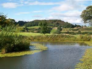
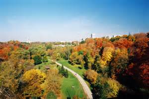
At 40 square kilometres, Rouge Park is a reservoir of biodiversity in Canada's most heavily populated region, the Greater Toronto Area, and an essential natural area in Ontario's Greenbelt. Not only do we have lands in the Rouge River watershed, but also in the neighbouring Petticoat Creek and Duffins Creek watersheds.
Natural beauty and biological diversity have long attracted people to the lands now protected in Rouge Park. Since the 1950s, governments and others considered the creation of a protected park.
In 1995, that vision was made a reality and Rouge Park was created to permanently protect these sensitive ecosystems for the public.
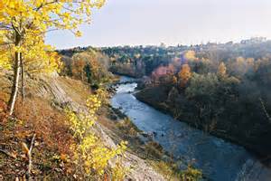
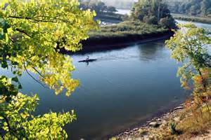
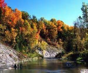
Rouge Park is Canada's premier urban wilderness park. Over 40 km2 (10,000 acres) in size, it is protected park land in the Rouge River, Petticoat Creek and Duffins Creek watersheds, in and near Toronto, Canada's largest city.
The headwaters, or source, of the 250 km-long Rouge River system are in the Oak Ridges Moraine, an important geologic feature north of Toronto. The Rouge River and its tributaries flow south into Toronto, through the marshes at Rouge Beach, and empty into Lake Ontario.
Rouge Park is the only place where the Ontario Greenbelt reaches Lake Ontario in the City of Toronto.

1749 Meadowvale rd
Scarbourough, Ontario
Canada