Pickering - Duffins Creek (Brock Rd.)
Park at No Frills store near southeast corner Brock and Hwy 2. Meet north of Finch at bridge on Brock Rd.
From the picturesque shores of Lake Ontario and bountiful woodlands to charming rural villages and a vibrant downtown, Pickering offers plenty of ways to enjoy natural beauty and popular attractions.
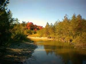
Our treasured waterfront is home to the Waterfront Trail, a scenic haven for cycling, in-line skating and leisurely strolls. Boating, fishing and water activities are favourite pastimes on Frenchman's Bay. Petticoat Creek, Duffins Creek, Seaton Hiking Trail and Greenwood and Claremont Conservation Areas offer extensive hiking and walking trails.
From Mill St. and Church St. the trail follows Duffins Trail System travelling through the environmentally sensitive area of Major-Spink. An underpass is in place to cross Kingston Rd., and two Duffins Creek overpasses, part of the mapped trail system, are in the construction stage.
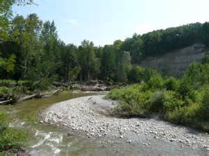
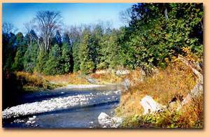
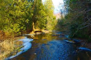
The trail is scenic, diverse and interesting, with cultural and natural history woven throughout. The creek is wide and fast, with steep embankments and cold water aquatic communities, including healthy self-sustaining populations of rainbow and brown trout.
ACTIVITIES
Hiking & Walking
Running
Equestrian
Cross Country Skiing
HOURS OF OPERATION
Year-round